Given the comments here, I thought I’d throw up a few local images I took of the aftermath. We live about 600′ above the Connecticut river and between here and there we have several little streams that feed down the hill and cross a few roads. Two of those crossings were washed out on Sunday.
Here are two photos I found of the Simon Pearce restaurant and Quechee bridge over at Gizmodo. You can see the falls and how the water filled the depression entirely. When you eat there, you sit on the white portion of the building to the left of the arched window. Amy and I have had the pleasure of sitting right on that railing a few times. The bridge is out of frame on the right and you have a great view of it while you eat. Last time we were there, kids were jumping off rocks below the bridge into the lower section of the falls.

These photos of the bridge are taken from opposite ends, but you get the idea. The end on the restaurant side is the one that’s been swept away.

The Taftsville Bridge is further up stream, instead of down stream like I said in the comments. It’s hard to remember the order of bridges sometimes.
EDIT:
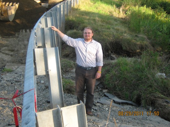
Here’s a photo my neighbor took of me standing down at Washout A. I asked him to take it to give some scale to the amount of earth that got moved out. My silly iPhone pics didn’t do it justice.

![photo[1]](http://www.beamychron.com/live/wp-content/uploads/2011/08/photo13-550x412.jpg)
![photo[2]](http://www.beamychron.com/live/wp-content/uploads/2011/08/photo23-550x412.jpg)
